Monitor festival ground conditions, protect accessible routes and make evidence-led intervention, closure and reopening decisions as weather and traffic change.
Festival ground condition monitoring is the planned observation, classification and response process used to keep pedestrian, accessible, vehicle and emergency routes suitable as weather, traffic and site activity change them. It turns the site plan from a static drawing into a live operating service.
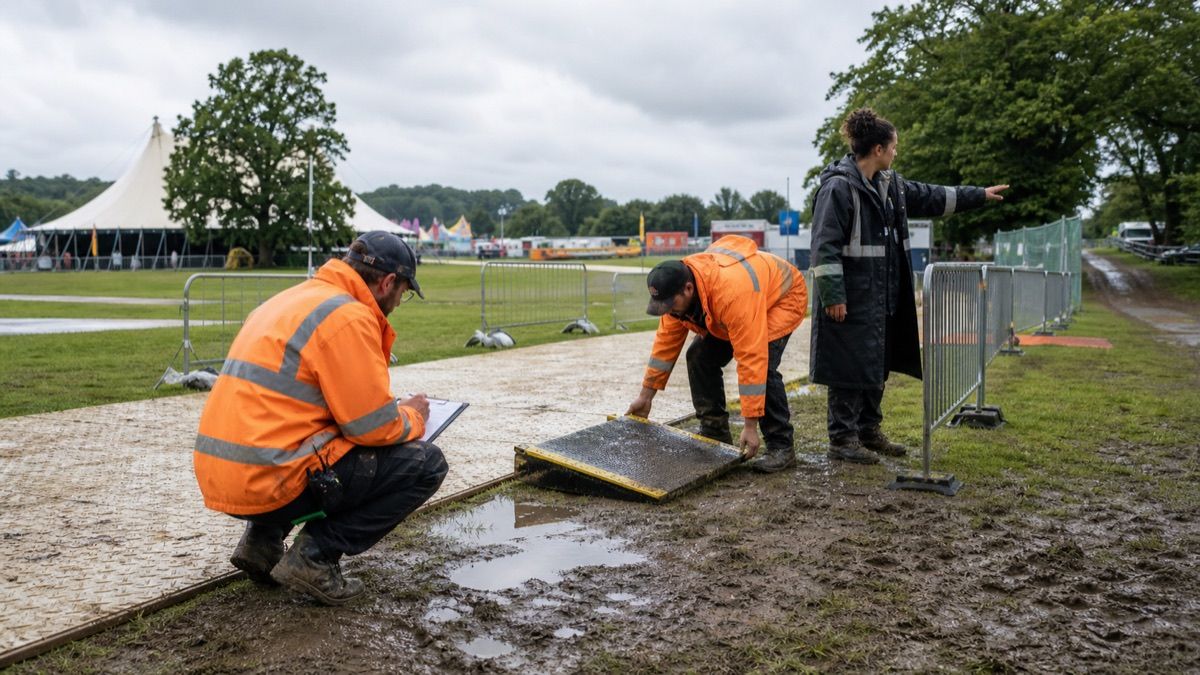
A route can be correct at handover and unusable hours later. Rain can soften an edge, vehicles can deform a crossing, a cable ramp can move, standing water can hide a level change and an improvised diversion can create a longer or steeper journey. This guide is an operating framework, not engineering, accessibility or legal advice; competent specialists and local requirements govern each event.
What should a festival ground-condition plan contain?
Map critical routes and junctions, name accountable owners, define inspection triggers, describe condition categories, pre-position suitable recovery resources, protect accessible alternatives, connect decisions to event control and record who closed or reopened each route.
The operating question is not whether a route exists on the plan. It is whether the whole journey remains usable under the conditions people face now.
Build one Forecast-to-Reopen chain
The Forecast-to-Reopen chain is a WENOTIFT operating model, not a technical standard. Its value is keeping observation, action and communication in the same loop.
Start with a route-and-surface baseline
Record the intended use of each route, its surface and width, changes in level, gradients, edges, crossings, drainage, lighting, nearby vehicle movements and connections to gates, viewing areas, toilets, water, welfare, transport and emergency facilities. Photograph important junctions from repeatable positions before the public arrives.
The UK Health and Safety Executive says event site design should consider ground conditions, topography, extreme weather and safe access for vehicles and pedestrians. It also recommends updating site plans as new information emerges. Those principles are useful internationally, but the responsible team must apply local law, design standards and competent advice.
Do not label one line on the map “accessible” and stop. Trace the journey from arrival to destination and back, including queue entrances, temporary crossings and any place where people must turn, pass or rest.
Use triggers instead of a vague promise to “check regularly”
Set inspection triggers that operations can recognise: a forecast threshold chosen with competent advice, the start or end of rainfall, opening, a crowd or vehicle movement, a reported slip, a drainage failure, a moved barrier, a route repair or a change of shift. Add time-based rounds only where they support those event-based checks.
| Condition signal | Immediate decision | Evidence to capture | Escalate when |
|---|---|---|---|
| Softening or rutting at a route edge | Protect the edge and inspect the full junction | Location, photograph, depth or extent method used | The route width or stable transition is reduced |
| Standing water | Isolate the source, assess depth and identify a usable alternative | Affected length, drainage condition and adjacent hazards | The surface or level change cannot be seen |
| Trackway or ramp movement | Stop use at the defect and secure the approach | Component, movement, fixing and supplier action | The installation no longer matches its design |
| Queue or barrier displacement | Restore a clear route and reassess crowd flow | New alignment and available passing space | The diversion creates pressure or blocks emergency access |
| Vehicle crossing damage | Separate traffic and pedestrians until checked | Crossing condition, traffic owner and repair | Load-bearing capacity or edge stability is uncertain |
| Repaired location | Test the entire connected journey before reopening | Checker, time, route and communication update | Any linked segment remains unavailable |
Avoid invented universal measurements. The correct thresholds depend on design, users, surface system, jurisdiction and competent assessment.
Protect accessible routes as a service priority
An accessible route should not become the last path repaired because fewer people are visibly using it. It connects people to the same event service, and an inaccessible segment can strand someone after entry. Give critical accessible journeys named priority in the site response plan.
When the intended route fails, an alternative must be genuinely usable and communicated—not merely technically present. Check distance, surface, gradient, width, crossings, lighting, queue interaction, steward support and whether the alternative reaches the same service. Speak with disabled people and accessibility specialists during planning and review rather than inferring every requirement from equipment alone.
Temporary trackway is not automatically an accessible solution. Its transitions, joints, movement, slip resistance, load, drainage and installation all matter. Supplier instructions and competent assessment should control its use.
Separate inspection from intervention authority
Stewards may observe and report; a site manager may classify; a specialist contractor may repair; event control may close a route; communications may update visitors. Put these boundaries in the plan so a report does not wait in a messaging group while everyone assumes someone else acted.
HSE's barrier guidance says barrier choice should account for layout, ground conditions, topography, weather and intended use, and warns that a control should not create greater risk than the problem it addresses. A quick diversion made from spare barriers therefore needs the same route and crowd-flow review as the defect it bypasses.
Use one location identifier across the site plan, radio call, work order and inspection log. “Muddy near food” is hard to dispatch; a named junction and route segment are actionable.
Design recovery resources before the rain
List available trackway components, edge treatments, drainage tools, pumps, absorbent or fill materials, barriers, lighting, towing capacity and competent installers. Confirm storage locations and transport routes. A recovery asset that sits behind the closed crossing or needs a vehicle that cannot enter soft ground is not ready.
Pre-agree which interventions require supplier approval or engineering review. Do not solve uncertain bearing capacity, electrical exposure or structural movement through improvised surface treatment. Coordinate with the festival temporary-power handoff, because standing water, buried services and cable routes can turn one ground intervention into another hazard.
Keep vehicles from undoing the repair
Separate pedestrian and vehicle movement where reasonably practicable. Protect repaired junctions from delivery traffic and define a controlled crossing when routes must meet. The HSE's current workplace transport guidance says traffic surfaces should be suitable, firm, even, drained, repaired and maintained, with conditions that do not expose people to slip or trip risks.
Revisit delivery schedules after rain. A route restored for pedestrian use may not be ready for plant or heavy vehicles. Record which use has been reopened rather than declaring the location simply “green.”
Communicate closures without creating a dead end
A closure message needs a location, affected journey, usable alternative, assistance method, start time and next review. Update stewards at both ends, not only the damaged point. Reflect the change at transport drop-offs, entry gates, information points and digital channels when relevant.
Avoid language that implies a disabled visitor should solve the disruption by finding a staff member somewhere else. Put support at the decision point and give teams a clear escalation route when the alternative does not meet an individual's needs.
This also matters at water stations. The festival drinking-water access plan shows how a usable route, queue and service point form one experience rather than separate assets.
Reopen only after an end-to-end check
Inspect the repair, approaches, transitions, drainage, barriers, lighting and the next connected segment. Confirm the intervention did not narrow a route, hide an edge, redirect water or conflict with a queue. Record the checker, time, condition category, evidence and communication update.
Reopening is not permanent approval. Keep the location on an enhanced watch list when rain, crowds or traffic can degrade it again. The event weather-insurance guide can help teams separate operational response from financial protection; a policy never replaces site control.
Learn from condition history
After the event, compare forecasts, reports, inspection triggers, interventions, closure duration, visitor feedback and repeated trouble spots. Ask which routes failed first, which materials moved, which communications lagged and which recovery resources were difficult to reach.
Preserve enough evidence to improve layout and procurement without collecting unnecessary personal information about reporters or visitors. The useful output is a better site model: where to relocate crossings, strengthen transitions, protect drainage, change vehicle windows or build a more resilient accessible journey next time.
Sources
- UK Health and Safety Executive: venue and site design
- UK Health and Safety Executive: using barriers at events
- UK Health and Safety Executive: driving surfaces
- UK Health and Safety Executive: crowd-management controls
Keep festival routes usable as conditions change.
Talk to WENOTIFT about site handoffs, accessibility operations and recovery decisions for live events.